Google Maps' Diplomatic Dance: Navigating International Naming and Border Disputes
, by Unboxify, 4 min reading time
, by Unboxify, 4 min reading time
The question of what we should believe and what we shouldn’t can be somewhat arbitrary. Even though we might have a spontaneous gut feeling about whether something is believable or not, can we really explain our reasoning for it? A perfect example of this is Google Maps' approach to the region between South Korea and Japan. If you use Google Maps in Japan, you’ll see "Sea of Japan". In South Korea, however, it appears as the “East Sea”. The same body of water—two distinct names, entirely dependent on your browsing location.
For the past two decades, Japan and South Korea have been embroiled in a dispute over the sea's name. South Koreans argue that the name “Sea of Japan” gained prominence during the period of Japanese occupation, preventing them from contesting the name internationally. On the other hand, Japan insists that the name was used long before the occupation and has historically been the internationally recognized term.
Google Maps navigates this tricky terrain by showing different maps to different users—an approach uniquely possible for an online map service. The method effectively avoids fueling international tensions while catering to regional sensibilities.
A similar situation exists in the Middle East between Arab countries and Iran. The international version of Google Maps labels the body of water as the "Persian Gulf". However, zoom in closer, and you'll also see the "Arabian Gulf". Iran argues that the name "Persian Gulf" has been consistently used throughout history. For countries like Iran and Saudi Arabia, this name holds substantial cultural and political significance.
Did You Know?
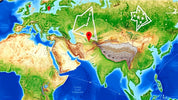
Both China and India claim the region designated as "Arunachal Pradesh" by India, which governs it. As long as you're using Google Maps from an Indian domain, the area is shown as part of India. Conversely, Chinese users see it as part of Southern Tibet. Only when accessed outside either country does Google Maps indicate the controversy with dotted border lines.
The same holds for Kashmir, an area claimed by India, China, and Pakistan. In India and China, the official maps of their respective governments are shown, with continuous lines that conceal the dispute. Rendering such borders as continuous lines creates a sense of international recognition where there might be none.
Leaving out growth markets like China and India would be a significant economic disadvantage for Google. Although Google had to move its services from mainland China to Hong Kong in 2010 to avoid the Chinese firewall, Google Maps still adheres to the Chinese government's viewpoint, even displaying the contentious "10-Dash Line". This line represents China's claim over several islands in the South China Sea, a region disputed for its rich fishing grounds, resources, and military importance.
The Crimean Peninsula remains a bone of contention between Ukraine and Russia. In 2014, a controversial referendum led Russia to claim Crimea as its territory. However, much of the international community regards this as a violation of international law. While the international version of Google Maps shows a dotted line, the Ukrainian version only reveals this at closer zoom levels, whereas the Russian version shows Crimea as unequivocally part of Russia.
Google often finds itself in the unenviable position where no map can avoid offending someone. Nevertheless, drawing a straight border in a disputed area could create facts that have a strong impact on the real situation on the ground.
Unlike Google Maps, the collaborative Wikipedia project also grapples with the challenge of neutrally portraying border conflicts. In the Crimean conflict, for example, the peninsula is shown as Russian territory on the Russian-language Wikipedia and part of Ukraine on the Ukrainian site. Discussions among authors on the correct way to handle disputes are often long-lasting and contentious.
Despite these challenges, Wikipedia opts to show disputes openly, even at the risk of being blocked. For instance, Wikipedia switched its web protocol to prevent countries from censoring individual articles. Now, countries must block Wikipedia entirely or not at all. This move resulted in Wikipedia being blocked in China.
Whether Google wants it or not, as the main player in online maps, it wields enormous power and responsibility. The maps that Google shows influence what a lot of people believe. It is vital to view maps critically, recognizing that what may seem like objective truths are often more subjective. The decisions made by mapmakers shape our understanding of the world daily. So next time you look at a map, remember: it's not just about geography—it's also about perspective.